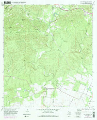
1970 Map of San Geronimo
USGS Topo · Published 1983About this map
The settlement at San Geronimo and the surrounding ranchlands are documented here as they appeared in 1970, showing a landscape defined by water and working land. Small rural cemeteries such as Lee Cem and Zapata Cem provide vital clues for genealogists tracking early families in this corner of the Texas Hill Country. The terrain is intricately marked by the drainage of San Geronimo Creek, Limekiln Creek, and Deep Creek, while the presence of Indian Mound Springs and Honeymoon Spring indicates the area’s historic reliance on natural water sources. Large operations like Gallagher Ranch and Kallison Ranch dominate the geography, supported by a network of functional infrastructure including Maverick Sch, a Radio Facility, and numerous remote wells like High Lonesome Well. This 1970s record, updated with 1982 revisions, preserves the cattle-country character before suburban expansion began to alter the region north of San Antonio.
Find a feature on this map
36 named features on this map. Tap any name to fly to it.
Don’t see what you’re looking for? This feature index may not catch every label — zoom into the map to look around manually.
Map Details
Editions of this 1970 San Geronimo Map
3 editions found
Other maps of this area

1953 · Culebra Hill
USGS Topo · 1:24,000

1953 · Helotes
USGS Topo · 1:24,000

1953 · Van Raub
USGS Topo · 1:24,000

1954 · San Antonio
USGS Topo · 1:250,000

1956 · Medina Lake
USGS Topo · 1:62,500

1957 · San Antonio
USGS Topo · 1:250,000

1958 · La Coste NE
USGS Topo · 1:24,000

1964 · Riomedina
USGS Topo · 1:24,000

1964 · Medina Lake
USGS Topo · 1:24,000
1966 · Culebra Hill
USGS Topo · 1:24,000