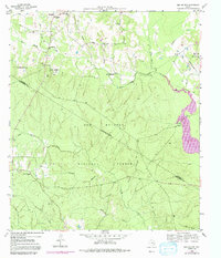
1959 Map of San Jacinto
USGS Topo · Published 1991About this map
The Sam Houston National Forest dominates this landscape on the border of Walker and Montgomery counties, as documented in this 1959 survey with later aerial updates. The small settlement of San Jacinto sits in the northwest corner, characterized by a cluster of community landmarks including Ebenezer Ch and the Little Zion Sch. Further east, the terrain around Blue Bonnet Hill gives way to a network of creeks like West Sandy Creek and Robinson Creek, which feed into the West Fork San Jacinto River.
Find a feature on this map
33 named features on this map. Tap any name to fly to it.
Don’t see what you’re looking for? This feature index may not catch every label — zoom into the map to look around manually.
Map Details
Editions of this 1959 San Jacinto Map
4 editions found
Other maps of this area

1954 · Beaumont
USGS Topo · 1:250,000

1957 · Beaumont
USGS Topo · 1:250,000

1958 · Lake Paula
USGS Topo · 1:24,000

1959 · Moore Grove
USGS Topo · 1:24,000

1959 · San Jacinto
USGS Topo · 1:24,000

1959 · Montgomery
USGS Topo · 1:24,000

1962 · Dacus
USGS Topo · 1:24,000

1962 · Richards
USGS Topo · 1:24,000

1962 · Galilee
USGS Topo · 1:24,000
1963 · Loma
USGS Topo · 1:24,000