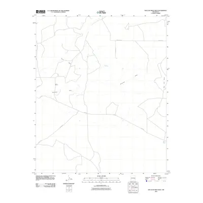
2010 Map of San Juan Mesa West
USGS Topo · Published 2010About this map
Billy the Kid Spring anchors the center of this Chaves County landscape, a vital water source in the arid terrain west of the San Juan Mesa escarpment. The 2010 geography is defined by a network of drainage features and grazing infrastructure, notably Hernandez Draw and the broad Olive Basin. Isolated landmarks like the Braun Windmill and Red Tank suggest the continued importance of livestock and ranching in this high-desert environment. Transport across the region is facilitated by a grid of rural routes, including Olive Rd and San Patricio Rd, which connect the scattered points of interest. This survey illustrates a quiet, working landscape where topographic names often reflect local history or the essential management of water.
Find a feature on this map
12 named features on this map. Tap any name to fly to it.
Don’t see what you’re looking for? This feature index may not catch every label — zoom into the map to look around manually.
Map Details
Editions of this 2010 San Juan Mesa West Map
This is the sole edition of this map. No revisions or reprints were ever made.
Other maps of this area

1954 · Fort Sumner
USGS Topo · 1:250,000

1954 · Clovis
USGS Topo · 1:250,000

1954 · Brownfield
USGS Topo · 1:250,000

1955 · Roswell
USGS Topo · 1:250,000

1958 · Brownfield
USGS Topo · 1:250,000

1958 · Fort Sumner
USGS Topo · 1:250,000

1958 · Clovis
USGS Topo · 1:250,000

1958 · Roswell
USGS Topo · 1:250,000

1962 · Roswell
USGS Topo · 1:250,000

1962 · Brownfield
USGS Topo · 1:250,000