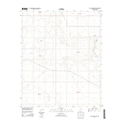
2013 Map of San Juan Mesa West
USGS Topo · Published 2013About this map
Billy the Kid Spring sits at the heart of this high-plains landscape, marking a historical water source in the arid cattle country of Eastern New Mexico. The terrain is defined by the prominent San Juan Mesa and the wide depressions of Olive Basin and Hernandez Draw. Ranching infrastructure is a primary feature of the area, evidenced by the presence of the Braun Windmill and localized water storage like Red Tank. A network of rural routes, including Bojax Rd and Co Road 3, provides the only access across these vast grazing lands. The map illustrates the characteristic section-line development of the West, where remote outposts and vital springs dictate the movement of people and livestock through the Chaves County desert.
Find a feature on this map
16 named features on this map. Tap any name to fly to it.
Don’t see what you’re looking for? This feature index may not catch every label — zoom into the map to look around manually.
Map Details
Editions of this 2013 San Juan Mesa West Map
This is the sole edition of this map. No revisions or reprints were ever made.
Other maps of this area

1954 · Fort Sumner
USGS Topo · 1:250,000

1954 · Clovis
USGS Topo · 1:250,000

1954 · Brownfield
USGS Topo · 1:250,000

1955 · Roswell
USGS Topo · 1:250,000

1958 · Brownfield
USGS Topo · 1:250,000

1958 · Fort Sumner
USGS Topo · 1:250,000

1958 · Clovis
USGS Topo · 1:250,000

1958 · Roswell
USGS Topo · 1:250,000

1962 · Roswell
USGS Topo · 1:250,000

1962 · Brownfield
USGS Topo · 1:250,000