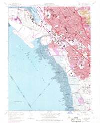
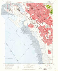
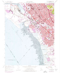
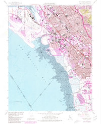
1959 Map of San Leandro
USGS Topo · Published 1969About this map
The eastern shore of San Francisco Bay shows a landscape in rapid transition during the mid-20th century. The urbanization of San Leandro and San Lorenzo is evident through the dense grid of residential streets and dozens of newly established schools like Arroyo High Sch and Pacific High Sch. This growth contrasts with the remaining marshlands and industrial infrastructure along the shoreline, including Mulford Landing and Hayward Landing. The Southern Pacific railroad and the Nimitz Freeway serve as the primary north-south transportation corridors, facilitating the region's post-war expansion.
Find a feature on this map
79 named features on this map. Tap any name to fly to it.
Don’t see what you’re looking for? This feature index may not catch every label — zoom into the map to look around manually.
Map Details
Editions of this 1959 San Leandro Map
4 editions found
Other maps of this area

1892 · San Mateo
USGS Topo · 1:62,500

1895 · San Francisco
USGS Topo · 1:62,500

1896 · San Mateo
USGS Topo · 1:62,500

1897 · Concord
USGS Topo · 1:62,500

1899 · San Francisco
USGS Topo · 1:62,500

1899 · Haywards
USGS Topo · 1:62,500

1899 · San Mateo
USGS Topo · 1:62,500

1915 · San Mateo
USGS Topo · 1:62,500

1915 · Haywards
USGS Topo · 1:62,500

1915 · Concord
USGS Topo · 1:62,500