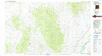
1979 Map of San Mateo Mountains
USGS Topo · Published 1993About this map
The San Mateo Mountains dominate the center of this high-desert landscape, where the Continental Divide winds through the western reaches of the Cibola National Forest. This mapping project, compiled from surveys between 1961 and 1979, illustrates the complex intersection of public forest lands and large private holdings like Pedro Armendaris No 34. In the eastern corridor, the Rio Grande feeds into the Elephant Butte Reservoir, creating a vital water source against the backdrop of the Magdalena Mountains. Human activity is marked by small settlements such as Monticello and Dusty, and the industrial footprint of the Rosedale Mine and Bell Mine. The western edge transitions into the Plains of San Agustin, while the southern reaches reveal the northern extent of the Black Range and the Gila National Forest.
Find a feature on this map
29 named features on this map. Tap any name to fly to it.
Don’t see what you’re looking for? This feature index may not catch every label — zoom into the map to look around manually.
Map Details
Editions of this 1979 San Mateo Mountains Map
2 editions found

Other maps of this area

1906 · Socorro
USGS Topo · 1:62,500

1911 · Alum Mountain
USGS Topo · 1:125,000

1913 · Alum Mountain
USGS Topo · 1:125,000

1916 · La Joya
USGS Topo · 1:125,000

1916 · Salinas Peak
USGS Topo · 1:125,000

1918 · Pelona
USGS Topo · 1:125,000

1948 · San Antonio
USGS Topo · 1:62,500

1948 · Val Verde
USGS Topo · 1:62,500

1948 · Malpais Well
USGS Topo · 1:62,500

1949 · Lookout Mountain
USGS Topo · 1:62,500