
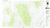
1979 Map of San Mateo Mountains
USGS Topo · Published 1979About this map
The San Mateo Mountains dominate this central New Mexico landscape, serving as a massive high-altitude divide between the Plains of San Agustin to the west and the Rio Grande valley to the east. At the southeastern edge of the range, the historic site of Fort Craig (Ruins) overlooks the river valley near the Elephant Butte Reservoir, marking a key nineteenth-century military outpost. The map details a rugged network of canyons such as Whitewater Canyon and Pigeon Canyon that drain the central highlands, where elevations reach peaks like Apache Kid Peak and Vicks Peak. To the west, the Continental Divide winds through the Black Range and Luera Mountains. Human settlement is sparse, characterized by isolated outposts and ranching locations like Dusty, Monticello, and Frenchmans Well, alongside evidence of earlier industry at Rosedale and Lost Mines Hill.
Find a feature on this map
129 named features on this map. Tap any name to fly to it.
Don’t see what you’re looking for? This feature index may not catch every label — zoom into the map to look around manually.
Map Details
Editions of this 1979 San Mateo Mountains Map
2 editions found
Other maps of this area

1906 · Socorro
USGS Topo · 1:62,500

1911 · Alum Mountain
USGS Topo · 1:125,000

1913 · Alum Mountain
USGS Topo · 1:125,000

1916 · La Joya
USGS Topo · 1:125,000

1916 · Salinas Peak
USGS Topo · 1:125,000

1918 · Pelona
USGS Topo · 1:125,000

1948 · San Antonio
USGS Topo · 1:62,500

1948 · Val Verde
USGS Topo · 1:62,500

1948 · Malpais Well
USGS Topo · 1:62,500

1949 · Lookout Mountain
USGS Topo · 1:62,500