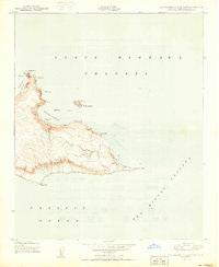
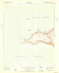
1950 Map of San Miguel Island East
USGS Topo · Published 1950About this map
Cuyler Harbor dominates the northern coast of this island landscape, protected by the offshore presence of Prince Island and Kid Rock. This 1950 edition, based on aerial surveys from just after the war, reveals a land of isolation and specialized naval or ranching activity. The interior is sparse, marked primarily by a Ranch and the Ranch House Flagpole, suggesting the presence of the island's sheep ranching era or early military oversight. The coastline is intensely detailed, from the dangerous outcrops of Judge Rock and Middle Rock to the prominent eastern reach of Cardwell Point. Features such as the Pole Cross and Rock Cairn (Nob) serve as critical navigational markers on an island otherwise defined by its windswept topography and the surrounding Santa Barbara Channel.
Find a feature on this map
24 named features on this map. Tap any name to fly to it.
Don’t see what you’re looking for? This feature index may not catch every label — zoom into the map to look around manually.
Map Details
Editions of this 1950 San Miguel Island East Map
This is the sole edition of this map. No revisions or reprints were ever made.
Other maps of this area
1943 · Santa Rosa Island West
USGS Topo · 1:24,000
1943 · San Miguel Island West
USGS Topo · 1:24,000
1943 · San Miguel Island East
USGS Topo · 1:24,000

1948 · Santa Maria
USGS Topo · 1:250,000
1950 · San Miguel Island West
USGS Topo · 1:24,000

1956 · Santa Maria
USGS Topo · 1:250,000

1957 · Santa Maria
USGS Topo · 1:250,000

1958 · Santa Maria
USGS Topo · 1:250,000

1962 · Santa Maria
USGS Topo · 1:250,000
1981 · Point Conception
USGS Topo · 1:100,000