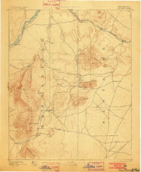
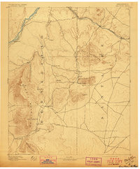
1892 Map of San Pedro
USGS Topo · Published 1902About this map
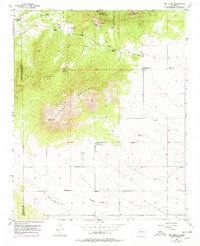
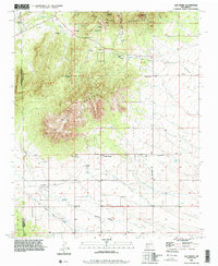
The Rio Grande flows through the northwest corner of this late nineteenth-century territory, marking a landscape where the Sandia Mountains and Ortiz Mountains define the rugged verticality of the terrain. Near the center, the mining and ranching settlements of San Pedro and Golden sit at the base of the San Pedro Mts., connected by a network of primitive roads that weave between high peaks and deep incisions like Tijeras Canyon. The importance of the rail economy is evident along the northern edge, where the Santa Fe Railroad and the A. T. & S. F. R. R. follow the curves of Galisteo Creek. This reconnaissance survey, conducted by R.H. Chapman and R.H. Phillips, captures a specific moment of development before statehood, documenting isolated outposts such as Tejon, Una de Gato, and Dolores that were essential to the region's early Territorial-era expansion.
Find a feature on this map
36 named features on this map. Tap any name to fly to it.
Don’t see what you’re looking for? This feature index may not catch every label — zoom into the map to look around manually.
Map Details
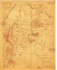
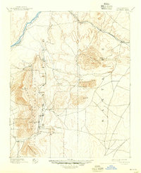
Editions of this 1892 San Pedro Map
5 editions found

Historical Maps of Albuquerque Through Time
8 maps found