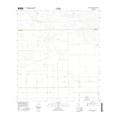
2016 Map of San Perlita North
USGS Topo · Published 2016About this map
San Perlita sits at the southern edge of this South Texas coastal plain survey, where the grid of established farm roads meets the more open, uncultivated ranchlands of the north. The landscape is defined by its water management and livestock history, evidenced by numerous tanks such as Tanque del Burro, Tanque los Cuates, and Santo Domingo Tank. The transition across the Kenedy County and Willacy County line highlights the contrast between the organized agricultural development near the town and the larger, more dispersed tracts to the north, including named locations like Tajitos and Los Becerros. A network of drainage and transportation, anchored by the East Main Drain and major thoroughfares like H Yturria Rd and Punta Del Monte Rd, supports the region's agricultural economy.
Find a feature on this map
36 named features on this map. Tap any name to fly to it.
Don’t see what you’re looking for? This feature index may not catch every label — zoom into the map to look around manually.
Map Details
Editions of this 2016 San Perlita North Map
This is the sole edition of this map. No revisions or reprints were ever made.
Other maps of this area

1921 · Tarida Ranch
USGS Topo · 1:62,500

1922 · La Sal Vieja
USGS Topo · 1:62,500

1953 · Brownsville
USGS Topo · 1:250,000

1956 · Rudolph
USGS Topo · 1:24,000

1956 · San Perlita South
USGS Topo · 1:24,000

1956 · Rosita Lake
USGS Topo · 1:24,000

1956 · San Perlita North
USGS Topo · 1:24,000
1956 · Rosita Lake NE
USGS Topo · 1:24,000
1956 · Willamar
USGS Topo · 1:24,000

1956 · Yturria
USGS Topo · 1:24,000