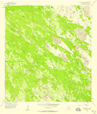
1956 Map of Rosita Lake NE
USGS Topo · Published 1958About this map
Shifting sand dunes and scattered water sources characterize this mid-century livestock landscape in South Texas. The map depicts a territory where survival and industry depend on scattered wells and windmills, including Colorado Windmill, San Jose Windmill, and the Huisachito Windmills. A network of private roads and extensive fences suggests a highly managed ranching environment. One of the most significant features for local history is a small site marked Graves located in the southwestern portion of the sheet, likely representing a private family burial ground on the ranch lands. The topography is dominated by large sand formations such as Shifting Sand Dunes, which rise above the brush and grass. Deep water access is noted at the Tecolote Artesian Well, while smaller features like Charco Nine Windmill and Moya Windmill serve the more remote reaches of this arid coastal plain.
Find a feature on this map
34 named features on this map. Tap any name to fly to it.
Don’t see what you’re looking for? This feature index may not catch every label — zoom into the map to look around manually.
Map Details
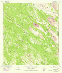
Editions of this 1956 Rosita Lake NE Map
2 editions found
Other maps of this area

1921 · Tarida Ranch
USGS Topo · 1:62,500

1923 · Lopena Island
USGS Topo · 1:62,500

1923 · Saltillo Ranch
USGS Topo · 1:62,500

1952 · South of Potrero Lopeno NW
USGS Topo · 1:24,000

1952 · Port Mansfield
USGS Topo · 1:24,000

1952 · Potrero Lopeno SW
USGS Topo · 1:24,000

1952 · Potrero Lopeno
USGS Topo · 1:62,500

1952 · South of Potrero Lopeno
USGS Topo · 1:62,500

1953 · Brownsville
USGS Topo · 1:250,000

1956 · Saltillo Well
USGS Topo · 1:24,000