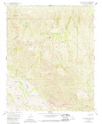
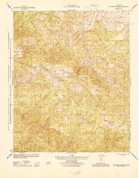
1959 Map of San Rafael Mtn
USGS Topo · Published 1989About this map
San Rafael Mtn and McKinley Mtn anchor this high-elevation backcountry terrain within the Los Padres National Forest. The landscape is defined by the sharp drainage systems of Manzana Creek and the South Fork Sisquoc River, where remote campsites like Manzana Narrows Camp and Mission Pine Camp provided essential refuge for wilderness travelers. This edition includes purple photorevisions from 1988, showing the expanded San Rafael Wilderness boundary. A network of primitive routes, including the Santa Cruz (Pack) Trail and various unnamed jeep trails, connects the mountain peaks to valley points such as the Santa Cruz Guard Station and Doty Cabin. The presence of many springs, including Grand Spring and Live Oak Spring, highlights the critical water sources that dictated movement through this interior range during the mid-20th century.
Find a feature on this map
29 named features on this map. Tap any name to fly to it.
Don’t see what you’re looking for? This feature index may not catch every label — zoom into the map to look around manually.
Map Details
Editions of this 1959 San Rafael Mtn Map
4 editions found
Other maps of this area

1902 · Santa Ynez
USGS Topo · 1:125,000

1905 · Santa Ynez
USGS Topo · 1:125,000

1941 · San Rafael Mtn.
USGS Topo · 1:62,500

1941 · McPherson Peak
USGS Topo · 1:62,500

1942 · San Rafael Mtn.
USGS Topo · 1:62,500

1942 · Little Pine Mountain
USGS Topo · 1:24,000

1943 · Big Pine Mountain
USGS Topo · 1:31,680

1943 · San Rafael Mtn.
USGS Topo · 1:62,500

1943 · McPherson Peak
USGS Topo · 1:62,500
1944 · Salisbury Potrero
USGS Topo · 1:31,680