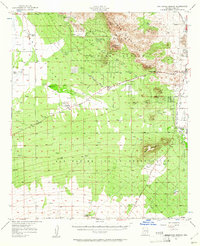
1957 Map of San Xavier Mission
USGS Topo · Published 1961About this map
The San Xavier del Bac Mission anchors this mid-century survey of the land southwest of Tucson, where desert preservation and indigenous history intersect. The landscape is defined by the San Xavier Indian Reservation and the Papago Indian Reservation, which occupy the level ground south of the volcanic peaks. On the eastern edge of the Tucson Mountain Park, the Desert Laboratory on Tumamoc Hill and the Arizona-Sonora Desert Museum highlight the area's significance for biological and environmental research.
Find a feature on this map
46 named features on this map. Tap any name to fly to it.
Don’t see what you’re looking for? This feature index may not catch every label — zoom into the map to look around manually.
Map Details
Editions of this 1957 San Xavier Mission Map
2 editions found

Other maps of this area

1904 · Patagonia
USGS Topo · 1:125,000

1904 · Tucson
USGS Topo · 1:125,000

1905 · Patagonia
USGS Topo · 1:125,000

1905 · Tucson
USGS Topo · 1:125,000

1920 · Arivaca
USGS Topo · 1:125,000

1925 · Samaniego Peak
USGS Topo · 1:62,500

1925 · San Xavier
USGS Topo · 1:62,500

1926 · Helvetia
USGS Topo · 1:62,500

1934 · Tucson Mountains
USGS Topo · 1:125,000

1939 · Twin Buttes
USGS Topo · 1:62,500