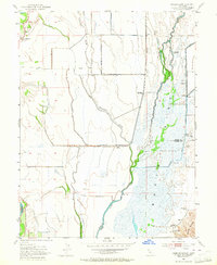
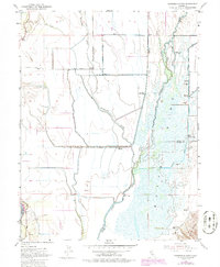
1952 Map of Sanborn Slough
USGS Topo · Published 1964About this map
The low-lying wetlands of the Sink dominate this landscape where the borders of Butte, Sutter, and Colusa counties converge. During the early 1950s, this area was defined by an intricate network of water management and seasonal flooding, evidenced by the numerous levee systems and waterways like Butte Creek and Sanborn Slough. The concentration of recreational land use is striking, with a high density of private sporting organizations such as the Sanborn Slough Gun Club, White Mallard Hunting Club, and the Wild Goose Country Club.
Find a feature on this map
26 named features on this map. Tap any name to fly to it.
Don’t see what you’re looking for? This feature index may not catch every label — zoom into the map to look around manually.
Map Details
Editions of this 1952 Sanborn Slough Map
5 editions found
Other maps of this area

1888 · Marysville
USGS Topo · 1:125,000

1891 · Marysville
USGS Topo · 1:125,000

1894 · Marysville
USGS Topo · 1:125,000

1895 · Marysville
USGS Topo · 1:125,000

1906 · Maxwell
USGS Topo · 1:62,500

1907 · Colusa
USGS Topo · 1:62,500

1911 · Sanborn Slough
USGS Topo · 1:31,680

1911 · Landlow
USGS Topo · 1:31,680

1912 · Marysville Buttes
USGS Topo · 1:31,680

1912 · Butte City
USGS Topo · 1:31,680