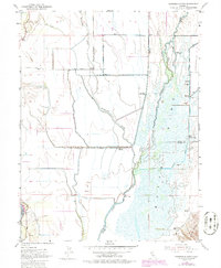
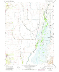
1952 Map of Sanborn Slough
USGS Topo · Published 1986About this map
Butte Sink dominates this landscape, revealing a complex network of wetlands and seasonal waterways in the heart of the Sacramento Valley. The map documents an area defined by its water management and hunting culture, where the Sacramento River and Butte Creek interact with numerous diversions. The prevalence of private sporting establishments, such as the Sanborn Slough Gun Club, White Mallard Hunting Club, and Wild Goose Country Club, illustrates the region's long-standing status as a premier waterfowl habitat.
Find a feature on this map
26 named features on this map. Tap any name to fly to it.
Don’t see what you’re looking for? This feature index may not catch every label — zoom into the map to look around manually.
Map Details
Editions of this 1952 Sanborn Slough Map
5 editions found
Other maps of this area

1888 · Marysville
USGS Topo · 1:125,000

1891 · Marysville
USGS Topo · 1:125,000

1894 · Marysville
USGS Topo · 1:125,000

1895 · Marysville
USGS Topo · 1:125,000

1906 · Maxwell
USGS Topo · 1:62,500

1907 · Colusa
USGS Topo · 1:62,500

1911 · Sanborn Slough
USGS Topo · 1:31,680

1911 · Landlow
USGS Topo · 1:31,680

1912 · Marysville Buttes
USGS Topo · 1:31,680

1912 · Butte City
USGS Topo · 1:31,680