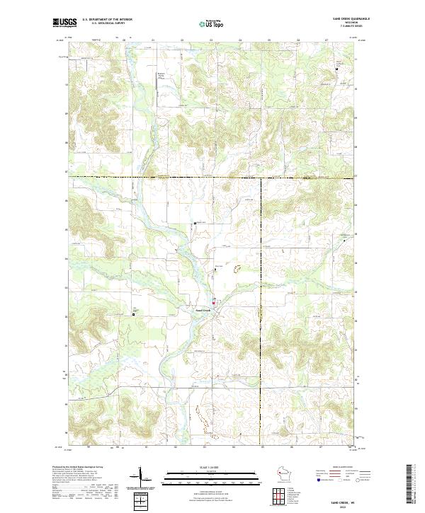
2022 Map of Sand Creek
USGS Topo · Published 2022About this map
The Red Cedar River carves a deep valley through the heart of this northwestern Wisconsin landscape, serving as the central geographic feature for the community of Sand Creek. This area, situated at the junction of Dunn, Barron, and Chippewa counties, reveals a rural settlement pattern defined by its watercourses and a network of county roads like Co Hwy I and Co Rd V. Genealogists will find a high density of burial grounds distributed across the townships, including Our Saviors Cem, Zion Cem, and Myran Cem, as well as the Dovre Lutheran Cem near the northern boundary. Smaller tributaries such as Cruikshank Cr, Tiller Cr, and Beaver Cr feed into the main river, while the Knutson Farms Airport provides a point of local aviation interest amidst the surrounding agricultural acreage and wooded bluffs.
Find a feature on this map
79 named features on this map. Tap any name to fly to it.
Don’t see what you’re looking for? This feature index may not catch every label — zoom into the map to look around manually.
Map Details
Editions of this 2022 Sand Creek Map
This is the sole edition of this map. No revisions or reprints were ever made.
Other maps of this area

1949 · New Auburn
USGS Topo · 1:62,500

1949 · Ridgeland
USGS Topo · 1:62,500

1951 · Ridgeland
USGS Topo · 1:62,500

1951 · New Auburn
USGS Topo · 1:62,500

1951 · Chetek
USGS Topo · 1:62,500

1951 · Barron
USGS Topo · 1:62,500

1953 · Rice Lake
USGS Topo · 1:250,000

1959 · Rice Lake
USGS Topo · 1:250,000
1975 · Colfax North
USGS Topo · 1:24,000
1975 · New Auburn
USGS Topo · 1:24,000