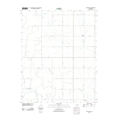
2012 Map of Sand Creek
USGS Topo · Published 2012About this map
The Salt Fork Arkansas River carves through the southwestern corner of this rural landscape, anchoring a region defined by agricultural grid lines and dispersed settlements. The community of Hawley sits near the southern boundary, supported by the nearby Hawley Cem. This area of Grant County is characterized by its drainage network, with Sand Cr and several unnamed tributaries flowing south toward the river. To the north, the small settlement of Sand Creek and the Fairview Cem mark the northern reaches of the quadrangle. The map reveals a highly structured road network, including numerous numbered routes like E0150 Rd and N2770 Rd, which provide access to localized landmarks such as Sarah Spg. This 2012 survey captures the persistent rural character of the Oklahoma plains in the early 21st century.
Find a feature on this map
22 named features on this map. Tap any name to fly to it.
Don’t see what you’re looking for? This feature index may not catch every label — zoom into the map to look around manually.
Map Details
Editions of this 2012 Sand Creek Map
This is the sole edition of this map. No revisions or reprints were ever made.
Other maps of this area

1955 · Enid
USGS Topo · 1:250,000

1955 · Woodward
USGS Topo · 1:250,000

1958 · Enid
USGS Topo · 1:250,000

1958 · Woodward
USGS Topo · 1:250,000

1968 · Wakita
USGS Topo · 1:24,000

1968 · Pond Creek NW
USGS Topo · 1:24,000

1968 · Wakita SW
USGS Topo · 1:24,000

1969 · Jet
USGS Topo · 1:24,000
1969 · Manchester
USGS Topo · 1:24,000

1969 · Nash
USGS Topo · 1:24,000