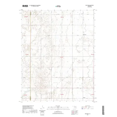
2018 Map of Sand Creek
USGS Topo · Published 2018About this map
Hawley and the surrounding plains of Grant County are defined by a grid of agricultural section roads and the winding course of the Salt Fork Arkansas River. The landscape is a transition between the high plains and the river basin, with Sand Creek and its namesake tributary, Sand Cr, draining the northern sections toward the Fairview Cem area. This 2018 survey documents a region where the legacy of early 20th-century settlement remains visible in the placement of local landmarks like Hawley Cem and the natural water source at Sarah Spring. The map's detailed topography reveals the subtle drainage patterns that dictated the placement of these community centers and family burial grounds relative to the river’s floodplain.
Find a feature on this map
44 named features on this map. Tap any name to fly to it.
Don’t see what you’re looking for? This feature index may not catch every label — zoom into the map to look around manually.
Map Details
Editions of this 2018 Sand Creek Map
This is the sole edition of this map. No revisions or reprints were ever made.
Other maps of this area

1955 · Enid
USGS Topo · 1:250,000

1955 · Woodward
USGS Topo · 1:250,000

1958 · Enid
USGS Topo · 1:250,000

1958 · Woodward
USGS Topo · 1:250,000

1968 · Wakita
USGS Topo · 1:24,000

1968 · Pond Creek NW
USGS Topo · 1:24,000

1968 · Wakita SW
USGS Topo · 1:24,000

1969 · Jet
USGS Topo · 1:24,000
1969 · Manchester
USGS Topo · 1:24,000

1969 · Nash
USGS Topo · 1:24,000