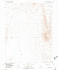
1967 Map of Sand Pass
USGS Topo · Published 1980About this map
Swasey Mountain and the Fish Springs Range dominate this high-desert landscape in west-central Utah, captured during a 1967 field check. The topographic survey illustrates a corridor of travel through Sand Pass, where the Sand Pass Road cuts between these prominent formations. The terrain falls away into the Tule Valley (Depression) to the west and Fish Springs Flat to the northeast, revealing a stark environment where water is a critical but scarce resource. The presence of the Roadside Reservoir near the pass suggests an essential stop for travelers or livestock moving through this arid territory. This edition also highlights the political boundary between Juab and Millard counties, which runs directly through the center of the valley, and records several Jeep Trails branching off into the mountain foothills.
Find a feature on this map
9 named features on this map. Tap any name to fly to it.
Don’t see what you’re looking for? This feature index may not catch every label — zoom into the map to look around manually.
Map Details
Editions of this 1967 Sand Pass Map
4 editions found
Other maps of this area

1908 · Fish Springs
USGS Topo · 1:250,000

1910 · Fish Springs
USGS Topo · 1:250,000

1953 · Delta
USGS Topo · 1:250,000

1958 · Delta
USGS Topo · 1:250,000

1959 · Cowboy Pass
USGS Topo · 1:62,500

1960 · Granite Mountain
USGS Topo · 1:62,500

1962 · Delta
USGS Topo · 1:250,000

1967 · Sand Pass
USGS Topo · 1:24,000

1967 · Sand Pass NW
USGS Topo · 1:24,000

1967 · Sand Pass SE
USGS Topo · 1:24,000