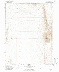
1967 Map of Sand Pass
USGS Topo · Published 1988About this map
Fish Springs Range dominates the northern horizon of this Great Basin landscape, where steep slopes descend into the vast Tule Valley (Depression). The map documents a desolate section of the West Desert at the boundary of Juab and Millard Counties, defined by the prominent Sand Pass that cuts between the mountains. Human activity is sparse, centered primarily on the infrastructure of Sand Pass Road and the functional Roadside Reservoir nestled near the pass itself. To the east, the terrain rises sharply toward Swasey Mountain, while the northeast corner levels out into the alkali-dusted Fish Springs Flat. This 1967 survey captures a geography of extreme isolation, illustrating the topographic transition between the high limestone ridges and the dry valley floors that characterize this part of western Utah.
Find a feature on this map
8 named features on this map. Tap any name to fly to it.
Don’t see what you’re looking for? This feature index may not catch every label — zoom into the map to look around manually.
Map Details
Editions of this 1967 Sand Pass Map
4 editions found
Other maps of this area

1908 · Fish Springs
USGS Topo · 1:250,000

1910 · Fish Springs
USGS Topo · 1:250,000

1953 · Delta
USGS Topo · 1:250,000

1958 · Delta
USGS Topo · 1:250,000

1959 · Cowboy Pass
USGS Topo · 1:62,500

1960 · Granite Mountain
USGS Topo · 1:62,500

1962 · Delta
USGS Topo · 1:250,000

1967 · Sand Pass
USGS Topo · 1:24,000

1967 · Sand Pass NW
USGS Topo · 1:24,000

1967 · Sand Pass SE
USGS Topo · 1:24,000