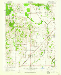
1958 Map of Sandborn
USGS Topo · Published 1959About this map
The White River and its associated lowlands define this landscape in the late 1950s, where intensive drainage projects like the Beehunter Ditch and Singer Ditch transformed the wet Green Bottom into productive farmland. Two major rail lines, the Pennsylvania and the Chicago Milwaukee St Paul and Pacific, intersect the terrain, supporting local commerce in settlements such as Sandborn and Marco. The northwestern corner of the quadrangle shows the early footprints of the extractive industry with a Strip Mine adjacent to the Greene-Sullivan State Forest. For the genealogist, the map preserves the locations of rural congregations and burial grounds, including Stafford Ch, Burris Chapel, and Begeman Cem. A notable geographic feature is the Indian Treaty Boundary, which cuts diagonally across the southern half of the sheet, marking a historical division in the township's development.
Find a feature on this map
46 named features on this map. Tap any name to fly to it.
Don’t see what you’re looking for? This feature index may not catch every label — zoom into the map to look around manually.
Map Details
Editions of this 1958 Sandborn Map
2 editions found
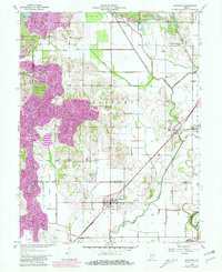
Other maps of this area

1938 · Switz City
USGS Topo · 1:24,000

1940 · Linton
USGS Topo · 1:24,000

1943 · Lyons
USGS Topo · 1:24,000

1943 · Sandborn
USGS Topo · 1:24,000

1943 · Bicknell
USGS Topo · 1:24,000

1943 · Plainville
USGS Topo · 1:24,000

1943 · Dugger
USGS Topo · 1:24,000

1943 · Epsom
USGS Topo · 1:24,000

1944 · Bucktown
USGS Topo · 1:24,000

1947 · Switz City
USGS Topo · 1:24,000