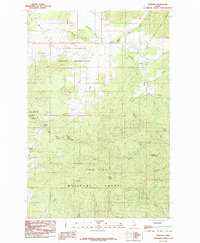
1985 Map of Sanders
USGS Topo · Published 1985About this map
Sanders serves as the primary settlement hub on this mid-1980s survey, situated where the Coeur D'Alene Indian Reservation meets the northern reaches of the St Joe National Forest. The landscape is defined by the headwaters of several drainages, most notably Hangman Creek and its South Fork, which carve through the high ground marked by Hump and Prospect Peak. A small local Cem is located near the village of Sanders, providing a specific point of interest for genealogists tracing families in this part of Benewah and Latah Counties. The western edge of the map includes a portion of the Mary Minerva McCroskey Memorial State Park, which stretches along the ridgeline including Marsh Hill. This transition between reservation land, national forest, and state park highlights a complex mosaic of land management and natural resources in northern Idaho.
Find a feature on this map
37 named features on this map. Tap any name to fly to it.
Don’t see what you’re looking for? This feature index may not catch every label — zoom into the map to look around manually.
Map Details
Editions of this 1985 Sanders Map
This is the sole edition of this map. No revisions or reprints were ever made.
Other maps of this area

1955 · Pullman
USGS Topo · 1:250,000

1955 · Spokane
USGS Topo · 1:250,000

1957 · Emida
USGS Topo · 1:62,500

1957 · Tensed
USGS Topo · 1:62,500

1958 · Spokane
USGS Topo · 1:250,000

1958 · Pullman
USGS Topo · 1:250,000

1960 · Potlatch
USGS Topo · 1:62,500

1961 · Deary
USGS Topo · 1:62,500

1981 · St Maries
USGS Topo · 1:100,000

1981 · Potlatch
USGS Topo · 1:100,000