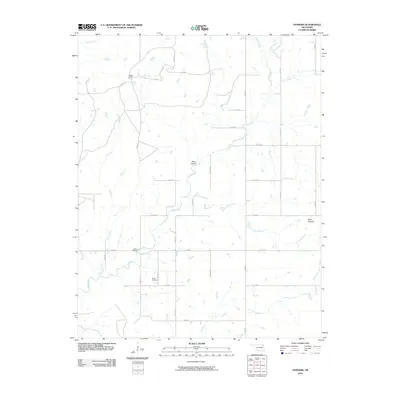
2010 Map of Sanders
USGS Topo · Published 2010About this map
Big Creek and its many tributaries, including Coal Creek and Looney Branch, dominate this landscape in Nowata County during the early 21st century. The map reveals a rural environment defined by sectional roads and ranching, evidenced by the Halsell Ranch in the northwest. Local landmarks such as Twin Bridges provide crossing points for these waterways, while the terrain is punctuated by significant rises like Blue Mound and the recesses of Blue Canyon.
Find a feature on this map
36 named features on this map. Tap any name to fly to it.
Don’t see what you’re looking for? This feature index may not catch every label — zoom into the map to look around manually.
Map Details
Editions of this 2010 Sanders Map
This is the sole edition of this map. No revisions or reprints were ever made.
Other maps of this area

1901 · Nowata
USGS Topo · 1:125,000

1901 · Vinita
USGS Topo · 1:125,000

1913 · Vinita
USGS Topo · 1:125,000

1914 · Nowata
USGS Topo · 1:125,000

1954 · Tulsa
USGS Topo · 1:250,000

1958 · Tulsa
USGS Topo · 1:250,000

1963 · Tulsa
USGS Topo · 1:250,000
1972 · Estella
USGS Topo · 1:24,000
1972 · Sanders
USGS Topo · 1:24,000
1972 · Chelsea NW
USGS Topo · 1:24,000