
1960 Map of Sanders
USGS Topo · Published 1962About this map
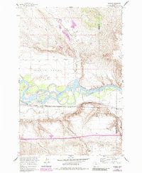
The Yellowstone River dominates this landscape as it meanders through the Mission Valley in south-central Montana. The small settlement of Sanders serves as a focal point for the region's transport and agriculture, situated along the Northern Pacific railroad line. The map reveals an intricate system of water management essential to the high plains, featuring the Yellowstone Canal and several siphons. North of the river, the drainage patterns are defined by interestingly named tributaries like Six Mile to Death Creek and Roach Coulee, while to the south, an Old Railroad Grade and numerous Spring labels indicate former transit paths and vital water sources for livestock. This survey illustrates the transition from traditional rail-dependent commerce to early 1960s industrial activities, marked by Gravel Pits and a prominent Storage Bin.
Find a feature on this map
16 named features on this map. Tap any name to fly to it.
Don’t see what you’re looking for? This feature index may not catch every label — zoom into the map to look around manually.
Map Details
Editions of this 1960 Sanders Map
2 editions found
Other maps of this area

1954 · Forsyth
USGS Topo · 1:250,000

1957 · Forsyth
USGS Topo · 1:250,000

1958 · Forsyth
USGS Topo · 1:250,000

1960 · Hysham
USGS Topo · 1:24,000

1960 · Vananda
USGS Topo · 1:24,000

1960 · Ahles
USGS Topo · 1:24,000

1968 · Donleys Reservoir
USGS Topo · 1:24,000

1968 · Finch
USGS Topo · 1:24,000
1971 · Griffin Coulee NW
USGS Topo · 1:24,000
1972 · Scraper Coulee
USGS Topo · 1:24,000