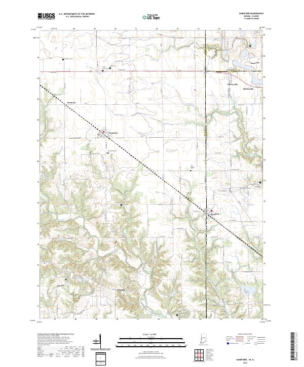
2022 Map of Sandford
USGS Topo · Published 2022About this map
The Illinois Indiana border cuts through this landscape, dividing small agricultural communities and intersecting a network of county roads. The settlement of Sandford sits near the state line, while Libertyville, Shirkieville, and Easytown cluster to the northeast. To the west, across the border in Illinois, lie the communities of Vermilion, Marley, and Elbridge. The terrain is defined by the winding paths of Sugar Cr and Little Sugar Cr, which carve through the farmland.
Find a feature on this map
64 named features on this map. Tap any name to fly to it.
Don’t see what you’re looking for? This feature index may not catch every label — zoom into the map to look around manually.
Map Details
Editions of this 2022 Sandford Map
This is the sole edition of this map. No revisions or reprints were ever made.
Other maps of this area

1932 · Marshall
USGS Topo · 1:62,500

1937 · Marshall
USGS Topo · 1:62,500

1941 · Terre Haute
USGS Topo · 1:24,000

1942 · Dennison
USGS Topo · 1:24,000

1947 · Paris
USGS Topo · 1:62,500

1948 · Terre Haute
USGS Topo · 1:24,000

1949 · Paris
USGS Topo · 1:62,500

1950 · New Goshen
USGS Topo · 1:24,000

1950 · Sandford
USGS Topo · 1:24,000

1951 · Clinton
USGS Topo · 1:24,000