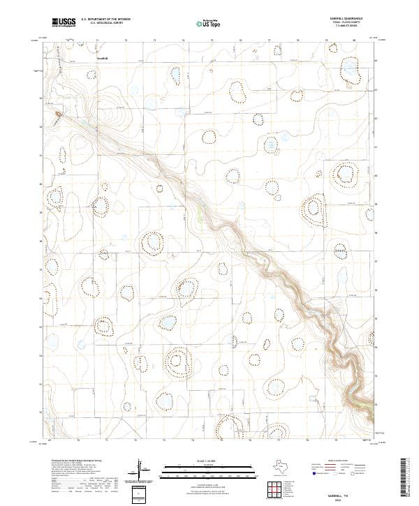
2022 Map of Sandhill
USGS Topo · Published 2022About this map
Sandhill sits at the northern edge of this West Texas landscape, where the agricultural grid meets the deep incisions of the White River. The riverbed itself dominates the central and southeastern geography, winding through the plains and joined by several drainage features including Callahan Draw and Running Water Draw. This modern survey illustrates a high-plains environment defined by large-scale irrigation and a network of Farm to Market roads like FM 378 and FM 37 that facilitate the regional cotton and grain economy. Scattered across the tableland are numerous depressions and seasonal water bodies, most notably Bois d'Arc Lake in the northeastern quadrant. To the southwest, the headwaters of Crawfish Cr emerge, tracing the edge of the caprock breaks that characterize this portion of Floyd County.
Find a feature on this map
39 named features on this map. Tap any name to fly to it.
Don’t see what you’re looking for? This feature index may not catch every label — zoom into the map to look around manually.
Map Details
Editions of this 2022 Sandhill Map
This is the sole edition of this map. No revisions or reprints were ever made.
Other maps of this area

1954 · Lubbock
USGS Topo · 1:250,000

1954 · Plainview
USGS Topo · 1:250,000

1958 · Plainview
USGS Topo · 1:250,000

1965 · Petersburg
USGS Topo · 1:24,000

1965 · Lockney SE
USGS Topo · 1:24,000

1965 · Cone
USGS Topo · 1:24,000

1965 · Floydada
USGS Topo · 1:24,000

1965 · Lockney
USGS Topo · 1:24,000

1965 · Floydada SE
USGS Topo · 1:24,000

1965 · Sandhill
USGS Topo · 1:24,000