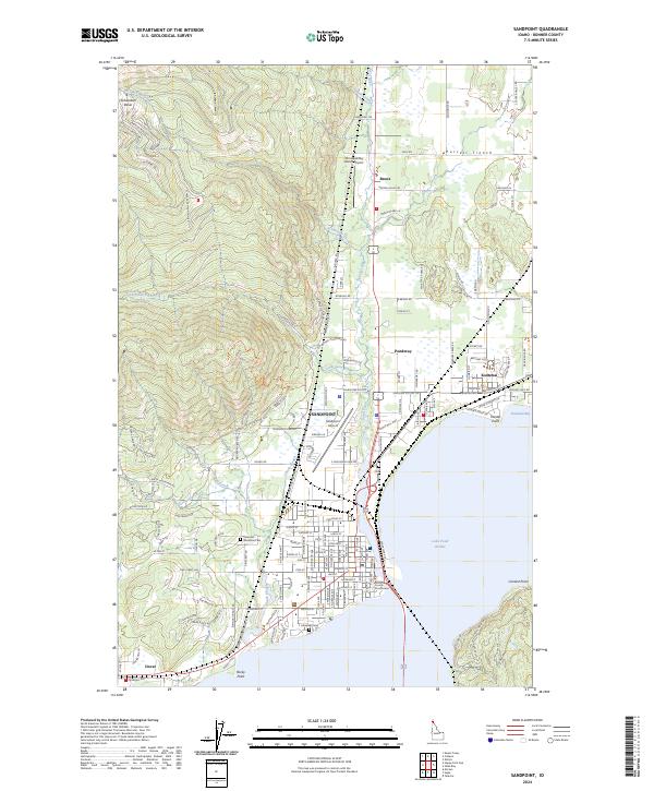
2024 Map of Sandpoint
USGS Topo · Published 2024About this map
Sandpoint serves as the focal point for this Idaho landscape, situated where the Purcell Trench meets the expansive waters of Lake Pend Oreille. The map reveals a transition from the urban grid of the county seat to the rising elevations of Schweitzer Basin, marked by specialized roads like Snowplow Rd and Telemark Rd. The transportation infrastructure is well-defined, showing the paths of Great Northern Rd and the Sandpoint Airport, while the proximity of neighboring communities such as Ponderay and Kootenai illustrates the residential growth along the northern shoreline.
Find a feature on this map
163 named features on this map. Tap any name to fly to it.
Don’t see what you’re looking for? This feature index may not catch every label — zoom into the map to look around manually.
Map Details
Editions of this 2024 Sandpoint Map
This is the sole edition of this map. No revisions or reprints were ever made.
Other maps of this area

1901 · Sandpoint
USGS Topo · 1:125,000

1911 · Priest Lake
USGS Topo · 1:250,000

1911 · Sandpoint
USGS Topo · 1:125,000

1913 · Priest Lake
USGS Topo · 1:250,000

1949 · Packsaddle Mtn
USGS Topo · 1:62,500

1951 · Packsaddle Mtn
USGS Topo · 1:62,500

1951 · Elmira
USGS Topo · 1:62,500

1958 · Sandpoint
USGS Topo · 1:250,000

1963 · Sandpoint
USGS Topo · 1:250,000
1968 · Happy Fork Gap
USGS Topo · 1:24,000