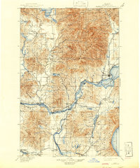
1901 Map of Sandpoint
USGS Topo · Published 1941About this map
The Selkirk Mountains dominate this northern Idaho landscape, rising sharply between the waters of Priest Lake and the expansive Pend Oreille Lake. At the turn of the century, the region's economy and settlement patterns were dictated by the intersection of major transcontinental transportation routes and the Pend Oreille River. The hub at Sandpoint shows the critical convergence of the Great Northern Railway and the Northern Pacific Railroad, which facilitated the growth of timber and transit towns like Laclede, Morton, and Kootenai.
Find a feature on this map
70 named features on this map. Tap any name to fly to it.
Don’t see what you’re looking for? This feature index may not catch every label — zoom into the map to look around manually.
Map Details
Editions of this 1901 Sandpoint Map
3 editions found
Other maps of this area

1901 · Sandpoint
USGS Topo · 1:125,000

1901 · Spokane
USGS Topo · 1:125,000

1903 · Rathdrum
USGS Topo · 1:125,000

1909 · Cataldo
USGS Topo · 1:125,000

1911 · Cataldo
USGS Topo · 1:125,000

1911 · Priest Lake
USGS Topo · 1:250,000

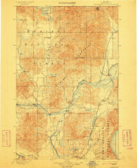
1911 · Sandpoint
USGS Topo · 1:125,000

1913 · Priest Lake
USGS Topo · 1:250,000

1934 · Metaline
USGS Topo · 1:125,000

1936 · Newport
USGS Topo · 1:96,000