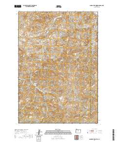
2020 Map of Sandrock Mountain
USGS Topo · Published 2020About this map
Sandrock Mountain and Horse Heaven Mountain anchor this central Oregon landscape along the border of Jefferson and Wheeler counties. The terrain is defined by a dense network of geological landmarks and water sources, including the distinct formations at Balanced Rocks, Indian Rocks, and the interestingly named Hole in Wall Rock. This high-desert environment shows a clear dependence on natural springs for livestock or early settlement, evidenced by White Rock Spring, Oler Spring, and Broken Shovel Spring. Steep canyons such as Domogalla Canyon and Studhorse Canyon cut through the volcanic topography, while the presence of Log House Spring suggests a history of localized human habitation or range management. Navigational points like Tompkins Pass and Red Gap indicate the natural corridors used to traverse this complex system of gulches and hollows.
Find a feature on this map
45 named features on this map. Tap any name to fly to it.
Don’t see what you’re looking for? This feature index may not catch every label — zoom into the map to look around manually.
Map Details
Editions of this 2020 Sandrock Mountain Map
This is the sole edition of this map. No revisions or reprints were ever made.
Other maps of this area

1926 · Mitchell
USGS Topo · 1:125,000

1955 · Bend
USGS Topo · 1:250,000

1957 · Bend
USGS Topo · 1:250,000

1958 · Bend
USGS Topo · 1:250,000

1966 · Antelope
USGS Topo · 1:62,500

1966 · Clarno
USGS Topo · 1:62,500

1968 · Horse Heaven Creek
USGS Topo · 1:24,000

1968 · Painted Hills
USGS Topo · 1:24,000

1968 · Lawson Mtn
USGS Topo · 1:24,000

1968 · Stephenson Mtn
USGS Topo · 1:24,000