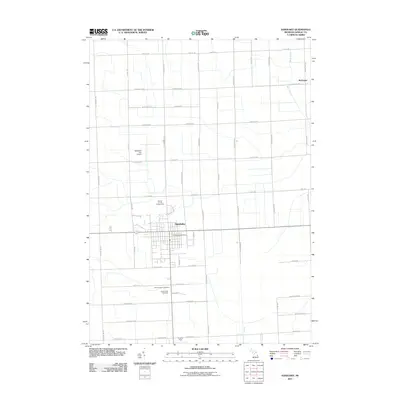
2011 Map of Sandusky
USGS Topo · Published 2011About this map
Sandusky serves as a central hub in Sanilac County, defined by a rigid grid of agricultural roads and local landmarks. This 2011 survey illustrates the town's role as a regional seat, anchored by the Sandusky Post Office and the Sanilac County Fairgrounds. To the south of the town center, legacy sites like Saint Joseph's Cemetery and Greenwood Cemetery provide valuable geographic markers for genealogists and local historians. The surrounding landscape is dominated by the upper reaches of the Black River, which flows through the northeast near the settlement of McGregor. The map also details the local infrastructure supporting the community, including the Sandusky City Airport to the northwest and Cowley Field at the southern edge of the quadrangle. The settlement pattern reflects a deeply established farming tradition, with mile-long road blocks such as W Snover Rd and Forester Rd partitioning the terrain.
Find a feature on this map
59 named features on this map. Tap any name to fly to it.
Don’t see what you’re looking for? This feature index may not catch every label — zoom into the map to look around manually.
Map Details
Editions of this 2011 Sandusky Map
This is the sole edition of this map. No revisions or reprints were ever made.
Other maps of this area

1954 · Flint
USGS Topo · 1:250,000

1958 · Flint
USGS Topo · 1:250,000

1963 · Snover
USGS Topo · 1:24,000

1963 · Sandusky
USGS Topo · 1:24,000

1963 · Peck
USGS Topo · 1:24,000

1963 · Juhl
USGS Topo · 1:24,000

1963 · Palms
USGS Topo · 1:24,000

1963 · Applegate
USGS Topo · 1:24,000

1963 · Deckerville
USGS Topo · 1:24,000

1963 · Argyle
USGS Topo · 1:24,000