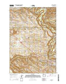
2014 Map of Sandy
USGS Topo · Published 2014About this map
The Sandy River carves a deep valley through the northeast corner of this landscape, separating Indian John Island from the rising terrain to the south. This area, where the suburban reaches of Gresham meet the foothills, is defined by a dense network of country roads like SE Lusted Rd and SE Orient Dr that connect long-standing rural communities. Settlements such as Orient, Pleasant Home, and Cottrell are scattered among the drainages of Johnson Cr and the various forks of Beaver Creek. To the south, the community of Boring sits near the headwaters of North Fork Deep Creek, while the town of Sandy serves as a gateway at the edge of the Tickle Creek basin. Local history is anchored at sites like the Pleasant Home Cem, while several private landing strips, including Schmidt Airport and Fly JLA Airport, reflect the region's diverse land use.
Find a feature on this map
89 named features on this map. Tap any name to fly to it.
Don’t see what you’re looking for? This feature index may not catch every label — zoom into the map to look around manually.
Map Details
Editions of this 2014 Sandy Map
This is the sole edition of this map. No revisions or reprints were ever made.
Other maps of this area

1911 · Boring
USGS Topo · 1:48,000

1914 · Boring
USGS Topo · 1:62,500

1916 · Estacada
USGS Topo · 1:125,000

1918 · Troutdale
USGS Topo · 1:62,500

1934 · Troutdale
USGS Topo · 1:48,000

1940 · Boring
USGS Topo · 1:62,500

1941 · Camas
USGS Topo · 1:62,500

1942 · Camas
USGS Topo · 1:62,500

1948 · Vancouver
USGS Topo · 1:250,000

1950 · Vancouver
USGS Topo · 1:250,000