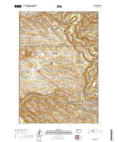
2020 Map of Sandy
USGS Topo · Published 2020About this map
Gresham and Sandy anchor the urban fringes of this landscape, where the foothills of the Cascades meet the suburban expansion of the Portland area. The map illustrates a dense network of water management and rural aviation, featuring the Sester Reservoirs and several private airfields like Schmidt Airport and Fly-JLA Airport. The transition from the residential street grids of Boring to the steep ravines of the Sandy River highlights the region's topography, where early transit corridors like the SE Mount Hood Loop follow the natural contours of the land.
Find a feature on this map
97 named features on this map. Tap any name to fly to it.
Don’t see what you’re looking for? This feature index may not catch every label — zoom into the map to look around manually.
Map Details
Editions of this 2020 Sandy Map
This is the sole edition of this map. No revisions or reprints were ever made.
Other maps of this area

1911 · Boring
USGS Topo · 1:48,000

1914 · Boring
USGS Topo · 1:62,500

1916 · Estacada
USGS Topo · 1:125,000

1918 · Troutdale
USGS Topo · 1:62,500

1934 · Troutdale
USGS Topo · 1:48,000

1940 · Boring
USGS Topo · 1:62,500

1941 · Camas
USGS Topo · 1:62,500

1942 · Camas
USGS Topo · 1:62,500

1948 · Vancouver
USGS Topo · 1:250,000

1950 · Vancouver
USGS Topo · 1:250,000