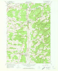
1958 Map of Sandy Creek
USGS Topo · Published 1973About this map
The New York Central Railroad corridor serves as the central spine of this landscape, connecting the villages of Pierrepont Manor, Mannsville, Lacona, and Sandy Creek. These settlements follow a distinct north-south axis, bordered by the branching waters of South Sandy Creek and Little Sandy Creek. The map documents a well-established rural social infrastructure, including the Sandy Creek Central Sch and several family or community burial grounds such as Maplewood Cem and Brewster Cem.
Find a feature on this map
59 named features on this map. Tap any name to fly to it.
Don’t see what you’re looking for? This feature index may not catch every label — zoom into the map to look around manually.
Map Details
Editions of this 1958 Sandy Creek Map
4 editions found
Other maps of this area

1893 · Sackets Harbor
USGS Topo · 1:62,500

1895 · Sacketts Harbor
USGS Topo · 1:62,500

1895 · Pulaski
USGS Topo · 1:62,500

1895 · Watertown
USGS Topo · 1:62,500

1898 · Watertown
USGS Topo · 1:62,500

1903 · Orwell
USGS Topo · 1:62,500

1905 · Orwell
USGS Topo · 1:62,500

1908 · Watertown
USGS Topo · 1:62,500

1909 · Watertown
USGS Topo · 1:62,500

1942 · Sandy Creek
USGS Topo · 1:24,000