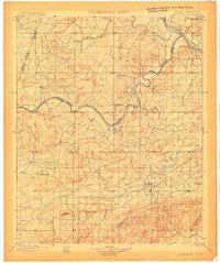
1900 Map of Sansbois
USGS Topo · Published 1900About this map
The Cherokee Nation Choctaw Nation Boundary Line defines the northern reaches of this territory, following the winding course of the Canadian River as it flows toward its confluence with the Arkansas River. Surveyed shortly before Oklahoma statehood, the landscape is dotted with early settlements like Whitefield, Stigler, and Enterprise, which served as local hubs amidst a network of creeks such as Duchess Creek and Dirty Creek. The southern terrain is dominated by the prominent peaks of Panther Mtn and Sansbois Mtn, with Tucker Knob rising as a central landmark.
Find a feature on this map
83 named features on this map. Tap any name to fly to it.
Don’t see what you’re looking for? This feature index may not catch every label — zoom into the map to look around manually.
Map Details
Editions of this 1900 Sansbois Map
2 editions found
Other maps of this area

1896 · Okmulgee
USGS Topo · 1:125,000

1898 · McAlester
USGS Topo · 1:125,000

1898 · Tahlequah
USGS Topo · 1:125,000

1900 · Sansbois
USGS Topo · 1:125,000

1900 · Canadian
USGS Topo · 1:125,000

1900 · Okmulgee
USGS Topo · 1:125,000

1900 · Sallisaw
USGS Topo · 1:125,000

1900 · Winding Stair
USGS Topo · 1:125,000

1901 · Muscogee
USGS Topo · 1:125,000

1901 · Tuskahoma
USGS Topo · 1:125,000