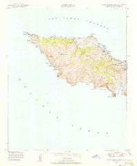
1943 Map of Santa Catalina West
USGS Topo · Published 1956About this map
The west end of Catalina Island West End Light defines this coastal landscape, where the ridges of the island rise sharply from the Pacific Ocean. Surveyed during the mid-1940s, the terrain is dominated by the height of Silver Peak and Mt Torquemada, while the coastline is a series of isolated landings and coves. The protected waters of Catalina Harbor and Lobster Bay show the natural maritime geography of the island’s narrow neck. Small outposts of activity are recorded, including the Girl Scouts Camp near Emerald Bay and a Quarry situated near the San Pedro Channel. From the north at Lands End to the sheltered Cherry Valley in the east, the map traces a network of shore-side features like Parsons Landing and Sullivans Beach that served as primary access points for this remote terrain before extensive modern development.
Find a feature on this map
38 named features on this map. Tap any name to fly to it.
Don’t see what you’re looking for? This feature index may not catch every label — zoom into the map to look around manually.
Map Details
Editions of this 1943 Santa Catalina West Map
4 editions found
Other maps of this area

1896 · San Pedro
USGS Topo · 1:62,500

1901 · Southern California Sheet No. 1
USGS Topo · 1:250,000

1904 · Southern California Sheet No. 1
USGS Topo · 1:250,000

1943 · San Pedro
USGS Topo · 1:125,000

1943 · Santa Catalina North
USGS Topo · 1:24,000

1943 · Santa Catalina South
USGS Topo · 1:24,000
1944 · San Pedro
USGS Topo · 1:62,500

1949 · Long Beach
USGS Topo · 1:250,000
1950 · Santa Catalina West
USGS Topo · 1:24,000
1950 · Santa Catalina South
USGS Topo · 1:24,000