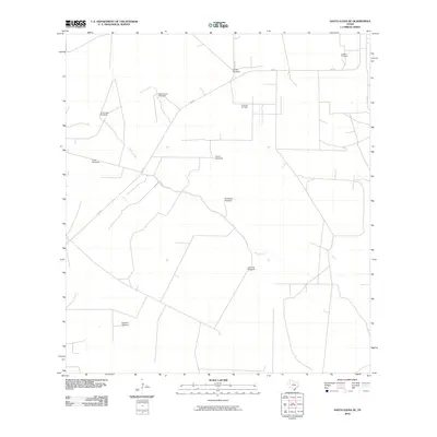
2010 Map of Santa Elena SE
USGS Topo · Published 2010About this map
Vargas Creek winds through this rural landscape in Hidalgo County, where water and energy resources define the local geography. The map reveals an area where traditional ranching infrastructure meets modern resource extraction, specifically at the Encinitas Oil Field. This intersection of industries is underscored by a network of named water sources across the terrain, including Agua Dulce Windmill, La Visnaga Windmill, and Sharps Windmill. A few primary roads like FM 755 and Co RD 314 provide the only major transportation corridors through the scrub. For genealogists and local historians, La Mesa Cemetery stands as a significant landmark in the northeast, marking the long-term presence of families in this semi-arid environment.
Find a feature on this map
14 named features on this map. Tap any name to fly to it.
Don’t see what you’re looking for? This feature index may not catch every label — zoom into the map to look around manually.
Map Details
Editions of this 2010 Santa Elena SE Map
This is the sole edition of this map. No revisions or reprints were ever made.
Other maps of this area

1939 · Linn
USGS Topo · 1:62,500

1939 · La Reforma
USGS Topo · 1:62,500

1939 · Encantada
USGS Topo · 1:62,500

1949 · Mc Allen
USGS Topo · 1:250,000

1954 · McAllen
USGS Topo · 1:250,000

1957 · Mc Allen
USGS Topo · 1:250,000

1962 · McAllen
USGS Topo · 1:250,000
1963 · Encino
USGS Topo · 1:24,000

1963 · Linn NW
USGS Topo · 1:24,000
1963 · Hartland
USGS Topo · 1:24,000