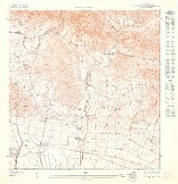
1947 Map of Santa Isabel NE
USGS Topo · Published 1947About this map
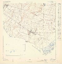
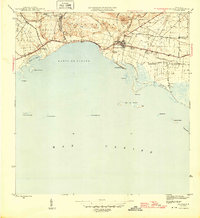
The agricultural landscape of southern Puerto Rico is clearly defined here during the late 1940s, a period when large estates and sugar production centers shaped the local economy. At the heart of the region, Central Cortada stands near the border of Municipio de Juana Diaz, serving as a primary industrial hub. The coastal plain is marked by several traditional haciendas, including Hacienda Florida, Hacienda Destino, and Hacienda Alomar, which are connected by a network of roads, canals, and a significant Linea de Transmision.
Find a feature on this map
20 named features on this map. Tap any name to fly to it.
Don’t see what you’re looking for? This feature index may not catch every label — zoom into the map to look around manually.
Map Details
Editions of this 1947 Santa Isabel NE Map
This is the sole edition of this map. No revisions or reprints were ever made.
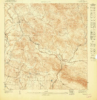
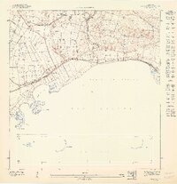
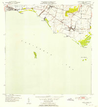
Other maps of this area

1944 · Santa Isabel
USGS Topo · 1:30,000

1945 · Rio Descalabrado
USGS Topo · 1:30,000
1945 · Salinas
USGS Topo · 1:30,000

1946 · Coamo
USGS Topo · 1:30,000
1947 · Rio Descalabrado SE
USGS Topo · 1:10,000
1947 · Santa Isabel NO
USGS Topo · 1:10,000
1947 · Rio Descalabrado SO
USGS Topo · 1:10,000
1947 · Coamo SO
USGS Topo · 1:10,000
1947 · Salinas NO
USGS Topo · 1:10,000
1952 · Santa Isabel
USGS Topo · 1:30,000
Featured Places
- Santa Isabel, Santa Isabel
- Estación Santa Isabel, Santa Isabel
- Santa Isabel
- Felicia I, Santa Isabel
- Barrio Pueblo, Santa Isabel