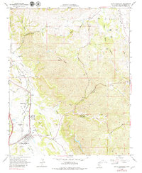
1965 Map of Santa Margarita
USGS Topo · Published 1979About this map
The Asistencia de Santa Margarita (Ruins) stands as a focal point for local history along the Salinas River, marking the site of an early Spanish colonial mission outpost. This mid-1960s landscape shows the transition from the ranching heritage of Happy Valley Ranch to the organized settlement of Santa Margarita. The Southern Pacific railroad corridor follows the river valley, facilitating the movement of goods through Cushing and past the agricultural plots of Garden Farms.
Find a feature on this map
63 named features on this map. Tap any name to fly to it.
Don’t see what you’re looking for? This feature index may not catch every label — zoom into the map to look around manually.
Map Details
Editions of this 1965 Santa Margarita Map
3 editions found
Other maps of this area

1897 · San Luis Obispo
USGS Topo · 1:62,500

1900 · San Luis
USGS Topo · 1:125,000

1914 · Cholame
USGS Topo · 1:125,000

1915 · Cholame
USGS Topo · 1:125,000

1917 · Cholame
USGS Topo · 1:125,000

1919 · Paso Robles
USGS Topo · 1:62,500

1922 · Pozo
USGS Topo · 1:62,500

1942 · San Luis Obispo
USGS Topo · 1:62,500

1943 · Paso Robles
USGS Topo · 1:62,500

1943 · Shedd Canyon
USGS Topo · 1:31,680