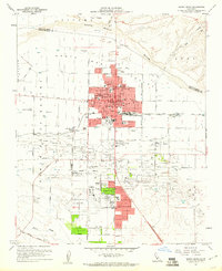
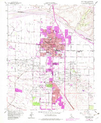
1959 Map of Santa Maria
USGS Topo · Published 1960About this map
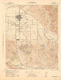
Santa Maria anchors this mid-century survey, revealing a landscape defined by the intersection of intensive agriculture and the petroleum industry. The extensive Santa Maria Valley Oil Field dominates the southern half of the quadrangle, where a dense network of oil wells and oil sumps spreads across the valley floor. This industrial footprint contrasts with the growing urban grid of the city, which features a robust collection of civic and educational institutions including Allen Hancock College, Joint Union High Sch, and various neighborhood campuses like Miller St School and Alvin Ave School.
Find a feature on this map
70 named features on this map. Tap any name to fly to it.
Don’t see what you’re looking for? This feature index may not catch every label — zoom into the map to look around manually.
Map Details
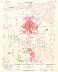
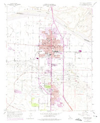
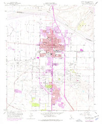
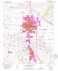
Editions of this 1959 Santa Maria Map
6 editions found
Other maps of this area

1897 · Arroyo Grande
USGS Topo · 1:62,500

1900 · San Luis
USGS Topo · 1:125,000

1905 · Guadalupe
USGS Topo · 1:125,000

1905 · Lompoc
USGS Topo · 1:125,000

1922 · Nipomo
USGS Topo · 1:62,500
1942 · Guadalupe
USGS Topo · 1:125,000

1942 · Lompoc
USGS Topo · 1:125,000
1942 · Arroyo Grande
USGS Topo · 1:62,500
1942 · Santa Maria
USGS Topo · 1:62,500

1942 · Point Sal
USGS Topo · 1:62,500