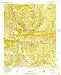
1951 Map of Santa Paula Peak
USGS Topo · Published 1957About this map
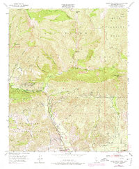
Santa Paula Ridge dominates the center of this 1950s landscape, a rugged terrain shaped by complex canyons and early industrial developments in Ventura County. Along the steep drainages of Santa Paula Creek and its many tributaries like Echo Falls Canyon and Anlauf Canyon, the map reveals a history of backcountry habitation through various outposts including Howell Place, Big Cone Camp, and Jackson Camp. The presence of Sulphur Springs and multiple Oil Wells near Timber Canyon reflects the area's mid-century reliance on natural resource extraction and mineral springs.
Find a feature on this map
35 named features on this map. Tap any name to fly to it.
Don’t see what you’re looking for? This feature index may not catch every label — zoom into the map to look around manually.
Map Details
Editions of this 1951 Santa Paula Peak Map
6 editions found
Other maps of this area

1900 · Piru
USGS Topo · 1:62,500

1903 · Santa Paula
USGS Topo · 1:62,500

1903 · Mt. Pinos
USGS Topo · 1:125,000

1903 · Tejon
USGS Topo · 1:125,000

1903 · Camulos
USGS Topo · 1:125,000

1921 · Piru
USGS Topo · 1:62,500

1941 · Piru
USGS Topo · 1:62,500

1942 · Santa Paula
USGS Topo · 1:62,500

1943 · Topatopa Mountains
USGS Topo · 1:24,000

1943 · Lion Canyon
USGS Topo · 1:24,000