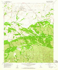
1959 Map of Santa Ynez
USGS Topo · Published 1960About this map
Santa Ynez serves as the focal point of this late 1950s survey, situated within the Santa Ynez Valley and adjacent to the Santa Ynez River. The landscape is a transition from the agricultural and ranching valley floor to the steep elevations of the Santa Ynez Mountains, much of which is protected within the Los Padres National Forest. Land use in this era is defined by large named holdings like the Juan y Lolita Ranch, San Lucas Ranch, and Rancho Piocha, alongside the presence of the Santa Ynez Airport and Santa Ynez Union High School. The terrain is deeply incised by numerous canyons and creeks, including Quiota Creek and Alamo Pintado Creek, which drain toward the river. Historic transit routes such as the San Marcos Pass Road and Refugio Road navigate these natural barriers, connecting the valley to the coastal passes at Refugio Pass.
Find a feature on this map
50 named features on this map. Tap any name to fly to it.
Don’t see what you’re looking for? This feature index may not catch every label — zoom into the map to look around manually.
Map Details
Editions of this 1959 Santa Ynez Map
3 editions found
Other maps of this area

1902 · Santa Ynez
USGS Topo · 1:125,000

1905 · Santa Ynez
USGS Topo · 1:125,000

1905 · Lompoc
USGS Topo · 1:125,000

1941 · San Rafael Mtn.
USGS Topo · 1:62,500

1942 · Lompoc
USGS Topo · 1:125,000

1942 · Gaviota
USGS Topo · 1:62,500

1942 · Goleta
USGS Topo · 1:62,500

1942 · San Rafael Mtn.
USGS Topo · 1:62,500

1942 · Los Olivos
USGS Topo · 1:62,500

1943 · San Rafael Mtn.
USGS Topo · 1:62,500