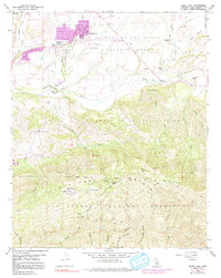
1959 Map of Santa Ynez
USGS Topo · Published 1991About this map
Santa Ynez serves as the hub of this Central Coast landscape, which transitions from the agricultural Santa Ynez Valley into the steep rises of the Santa Ynez Mountains. The 1959 survey, updated with mid-1970s suburban growth shown in purple, captures a period when the town core around Santa Ynez Union High School was beginning to expand. To the south and east, the map details the vast cattle and horse ranching heritage of the region, naming several substantial holdings including Juan y Lolita Ranch and Rancho Piocha.
Find a feature on this map
47 named features on this map. Tap any name to fly to it.
Don’t see what you’re looking for? This feature index may not catch every label — zoom into the map to look around manually.
Map Details
Editions of this 1959 Santa Ynez Map
3 editions found
Other maps of this area

1902 · Santa Ynez
USGS Topo · 1:125,000

1905 · Santa Ynez
USGS Topo · 1:125,000

1905 · Lompoc
USGS Topo · 1:125,000

1941 · San Rafael Mtn.
USGS Topo · 1:62,500

1942 · Lompoc
USGS Topo · 1:125,000

1942 · Gaviota
USGS Topo · 1:62,500

1942 · Goleta
USGS Topo · 1:62,500

1942 · San Rafael Mtn.
USGS Topo · 1:62,500

1942 · Los Olivos
USGS Topo · 1:62,500

1943 · San Rafael Mtn.
USGS Topo · 1:62,500