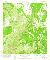
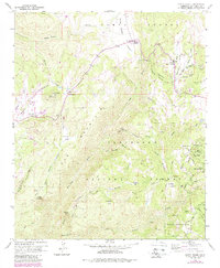
1960 Map of Santa Ysabel
USGS Topo · Published 1962About this map
Santa Ysabel and the high valleys of the Peninsular Ranges appear here at the start of the 1960s, a landscape defined by cattle ranching and indigenous heritage. The Santa Ysabel Indian Res and Inaja Indian Reservation occupy significant portions of this terrain, while the settlement at Wynola serves as a local hub near the Spencer Valley Sch. Evidence of earlier resource extraction persists in the northeast, where the Old Virginia Mine and the Pride of the West Mine are situated among the canyons.
Find a feature on this map
63 named features on this map. Tap any name to fly to it.
Don’t see what you’re looking for? This feature index may not catch every label — zoom into the map to look around manually.
Map Details
Editions of this 1960 Santa Ysabel Map
5 editions found
Other maps of this area

1893 · El Cajon
USGS Topo · 1:62,500

1901 · Elcajon
USGS Topo · 1:62,500

1903 · Cuyamaca
USGS Topo · 1:125,000

1903 · Elcajon
USGS Topo · 1:62,500

1903 · Ramona
USGS Topo · 1:125,000

1904 · Southern California Sheet No. 2
USGS Topo · 1:250,000

1939 · El Cajon
USGS Topo · 1:62,500

1939 · Santa Ysabel
USGS Topo · 1:62,500

1942 · El Cajon
USGS Topo · 1:62,500

1942 · Ramona
USGS Topo · 1:62,500