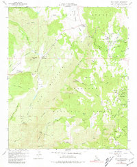
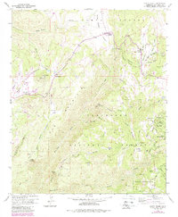
1960 Map of Santa Ysabel
USGS Topo · Published 1981About this map
Santa Ysabel Indian Res and the Inaja Indian Reservation anchor this 1960s study of the high country east of Escondido. The map reveals a landscape defined by ranching and small-scale mining, with the Old Virginia Mine and the Pride of the West Mine situated near Juch Canyon. Educational hubs for these remote communities are marked at Santa Ysabel Sch and Spencer Valley Sch, while the Inaja Memorial Park stands near the junction of the San Diego River and Santa Ysabel Creek. The presence of several high-elevation flats, such as Kessler Flat and Deadman Flat, suggests a pattern of seasonal grazing or early homesteading within the Cleveland National Forest. Topographical landmarks like Witch Creek Mtn and the steep descent of Mildred Falls illustrate the transition from the Ballena Valley into the deeper backcountry.
Find a feature on this map
55 named features on this map. Tap any name to fly to it.
Don’t see what you’re looking for? This feature index may not catch every label — zoom into the map to look around manually.
Map Details
Editions of this 1960 Santa Ysabel Map
5 editions found
Other maps of this area

1893 · El Cajon
USGS Topo · 1:62,500

1901 · Elcajon
USGS Topo · 1:62,500

1903 · Cuyamaca
USGS Topo · 1:125,000

1903 · Elcajon
USGS Topo · 1:62,500

1903 · Ramona
USGS Topo · 1:125,000

1904 · Southern California Sheet No. 2
USGS Topo · 1:250,000

1939 · El Cajon
USGS Topo · 1:62,500

1939 · Santa Ysabel
USGS Topo · 1:62,500

1942 · El Cajon
USGS Topo · 1:62,500

1942 · Ramona
USGS Topo · 1:62,500