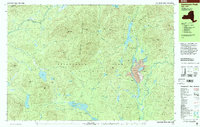
1999 Map of Santanoni Peak
USGS Topo · Published 2001About this map
Industrial history and wild peaks converge in this survey of the Newcomb area within Adirondack Park. The eastern corridor of the map is dominated by the resource extraction operations at Tahawus, featuring a large Strip Mine, extensive Tailings, and a Tailings Pond along the banks of Sanford Lake. This site is particularly significant for its connection to the 19th-century iron industry, marked here by the Old MacIntyre Furnace near the headwaters of the Hudson River.
Find a feature on this map
76 named features on this map. Tap any name to fly to it.
Don’t see what you’re looking for? This feature index may not catch every label — zoom into the map to look around manually.
Map Details
Editions of this 1999 Santanoni Peak Map
This is the sole edition of this map. No revisions or reprints were ever made.
Other maps of this area

1895 · Mt. Marcy
USGS Topo · 1:62,500

1897 · Schroon Lake
USGS Topo · 1:62,500

1898 · Newcomb
USGS Topo · 1:62,500

1901 · Newcomb
USGS Topo · 1:62,500

1902 · Mt. Marcy
USGS Topo · 1:62,500

1903 · Blue Mountain
USGS Topo · 1:62,500

1904 · Santanoni
USGS Topo · 1:62,500

1904 · Long Lake
USGS Topo · 1:62,500

1948 · Ogdensburg
USGS Topo · 1:250,000

1950 · Glens Falls
USGS Topo · 1:250,000