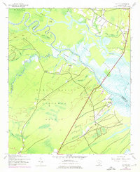
1943 Map of Santee
USGS Topo · Published 1976About this map
The Santee River delta dominates this landscape, where the waterway splits into the North Santee River and South Santee River around Hampton Island. Significant historical landholdings line the riverbanks, including the grounds of Hampton Plantation, Wedge Plantation, and Harrietta Plantation. These sites, along with the nearby Germantown settlement, reflect the agricultural and social structure of this coastal region before mid-century modernizations.
Find a feature on this map
48 named features on this map. Tap any name to fly to it.
Don’t see what you’re looking for? This feature index may not catch every label — zoom into the map to look around manually.
Map Details
Editions of this 1943 Santee Map
3 editions found
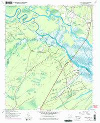
Other maps of this area

1942 · Cedar Creek
USGS Topo · 1:24,000

1942 · Cape Romain
USGS Topo · 1:24,000

1942 · Mc Clellanville
USGS Topo · 1:24,000

1942 · Honey Hill
USGS Topo · 1:24,000

1943 · Kilsock Bay
USGS Topo · 1:24,000

1943 · Santee
USGS Topo · 1:24,000

1943 · Awendaw
USGS Topo · 1:24,000

1943 · Minim Island
USGS Topo · 1:24,000

1943 · Georgetown South
USGS Topo · 1:24,000

1947 · Georgetown South
USGS Topo · 1:24,000