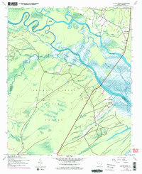
1943 Map of South Santee
USGS Topo · Published 1976About this map
Hampton Plantation and other historic river estates define the landscape of the Lowcountry just after the Second World War. The area is dominated by the intricate waterways of the Santee River, which splits into the North Santee River and South Santee River as it moves toward the coast. The terrain is a complex mix of tidal marshes and dense woodlands within the Francis Marion National Forest, where the transition from river swamp to upland forest is marked by numerous creeks like Wambaw Creek and Hampton Creek.
Find a feature on this map
40 named features on this map. Tap any name to fly to it.
Don’t see what you’re looking for? This feature index may not catch every label — zoom into the map to look around manually.
Map Details
Editions of this 1943 South Santee Map
3 editions found
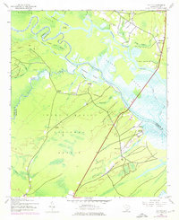
Other maps of this area

1942 · Cedar Creek
USGS Topo · 1:24,000

1942 · Cape Romain
USGS Topo · 1:24,000

1942 · Mc Clellanville
USGS Topo · 1:24,000

1942 · Honey Hill
USGS Topo · 1:24,000

1943 · Kilsock Bay
USGS Topo · 1:24,000

1943 · Santee
USGS Topo · 1:24,000

1943 · Awendaw
USGS Topo · 1:24,000

1943 · Minim Island
USGS Topo · 1:24,000

1943 · Georgetown South
USGS Topo · 1:24,000

1947 · Georgetown South
USGS Topo · 1:24,000