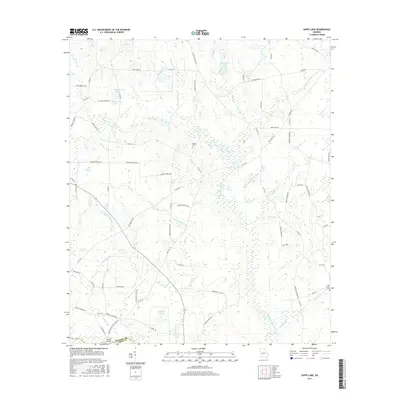
2017 Map of Sapps Lake
USGS Topo · Published 2017About this map
Vickers Cem and Flat Creek Cem stand as quiet sentinels in this rural landscape along the border of Cook and Berrien counties. The terrain is defined by a intricate network of sluggish waterways and wetlands, where the Withlacoochee River and New River converge. This 2017 survey reveals a landscape of scattered lakes, including Sapps Lake and McMillian Lake, interconnected by numerous small branches and creeks like Cypress Cr and Hardy Mill Creek.
Find a feature on this map
78 named features on this map. Tap any name to fly to it.
Don’t see what you’re looking for? This feature index may not catch every label — zoom into the map to look around manually.
Map Details
Editions of this 2017 Sapps Lake Map
This is the sole edition of this map. No revisions or reprints were ever made.
Other maps of this area

1953 · Waycross
USGS Topo · 1:250,000

1958 · Waycross
USGS Topo · 1:250,000

1972 · Tenmile Bay
USGS Topo · 1:24,000

1973 · Adel
USGS Topo · 1:24,000

1973 · Sapps Lake
USGS Topo · 1:24,000

1973 · Nashville West
USGS Topo · 1:24,000

1973 · Enigma
USGS Topo · 1:24,000

1973 · Lenox
USGS Topo · 1:24,000

1973 · Tifton East
USGS Topo · 1:24,000
1977 · Alapaha
USGS Topo · 1:24,000