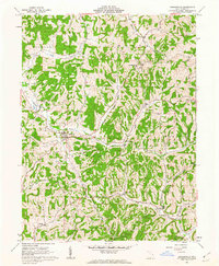
1961 Map of Sarahsville
USGS Topo · Published 1963About this map
Sarahsville and the surrounding hill country of Noble County reflect a landscape of deep-cut ridges and traditional ridge-top settlements. The 1961 topography reveals the enduring rural character of villages like Mt Ephraim and Whigville, while industrial activity is evidenced by multiple Strip Mine and Strip Mines operations cutting into the terrain. Genealogy researchers can find several rural congregations and burial sites, including Pleasant Hill Ch and its accompanying Pleasant Hill Cem, alongside the Green Valley Ch situated near the fork of the creek. The drainage network is particularly detailed, showing how the North Fork Buffalo Creek and South Fork Buffalo Creek define the local geography. Surveyed by the U.S. Geological Survey with aerial photography from 1960, this document captures the county as a mix of small farms, hilltop churches, and emerging energy extraction.
Find a feature on this map
42 named features on this map. Tap any name to fly to it.
Don’t see what you’re looking for? This feature index may not catch every label — zoom into the map to look around manually.
Map Details
Editions of this 1961 Sarahsville Map
2 editions found
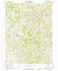
Other maps of this area

1903 · Macksburg
USGS Topo · 1:62,500

1905 · Macksburg
USGS Topo · 1:62,500

1909 · Caldwell
USGS Topo · 1:62,500

1909 · Summerfield
USGS Topo · 1:62,500

1911 · Cumberland
USGS Topo · 1:62,500

1911 · Summerfield
USGS Topo · 1:62,500

1912 · Caldwell
USGS Topo · 1:62,500

1949 · Clarksburg
USGS Topo · 1:250,000

1956 · Clarksburg
USGS Topo · 1:250,000

1961 · Clarksburg
USGS Topo · 1:250,000