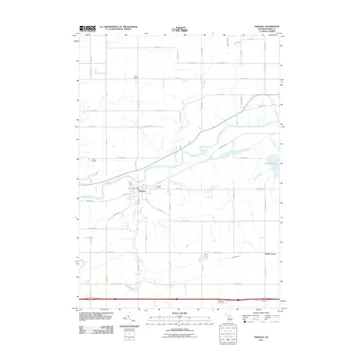
2011 Map of Saranac
USGS Topo · Published 2011About this map
The Grand River carves a winding path through the center of this Ionia County landscape, serving as the historical and geographical anchor for the village of Saranac. At this point in the early 21st century, the village remains a compact hub of activity, featuring the Saranac Post Office and the Saranac Cemetery nearby. North of the river, Potters Corners marks a rural intersection, while the southern reaches are defined by a network of waterways including Lake Creek and Peck Lake. To the west, the White Cemetery stands along Centerline Rd, offering a point of interest for genealogists tracing local families. The map also captures several smaller bodies of water like Cahoon Lake and Marker Lake, illustrating a landscape heavily influenced by glacial drainage and a well-developed grid of country roads such as David Hwy and Jordan Lake Rd.
Find a feature on this map
63 named features on this map. Tap any name to fly to it.
Don’t see what you’re looking for? This feature index may not catch every label — zoom into the map to look around manually.
Map Details
Editions of this 2011 Saranac Map
This is the sole edition of this map. No revisions or reprints were ever made.
Other maps of this area

1916 · Ionia
USGS Topo · 1:62,500

1918 · Ionia
USGS Topo · 1:62,500

1918 · Lowell
USGS Topo · 1:62,500

1943 · Ionia
USGS Topo · 1:62,500

1943 · Lowell
USGS Topo · 1:62,500

1954 · Midland
USGS Topo · 1:250,000

1958 · Midland
USGS Topo · 1:250,000

1958 · Grand Rapids
USGS Topo · 1:250,000

1959 · Midland
USGS Topo · 1:250,000

1961 · Grand Rapids
USGS Topo · 1:250,000